Tuesday, August 31, 2010

Wrapping It Up – Alaska Adventure 2010

Aug 20 - 22:  We had mixed feelings when we pulled out of Hyder, Alaska, on the final leg of our Alaska Adventure.   The three-month trip has been a feast for the senses, packed with excitement and yet also with a certain kind of peace.  We have our own chronicles of the “Land of the Midnight Sun” and of the “last frontier.”  It was an outstanding time!   But, we both agreed we were ready to wrap up the trip.  We have the right combination of things we did and didn’t do.  Maybe we’ll come back to complete the exploration some other time. So, we chose a wrapping-it-up route back to the lower 48. Here we go.

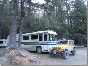
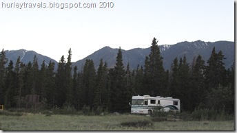
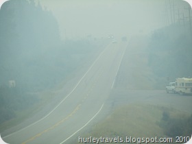
For the end of our trip we decided to cross back over into the United States at the Canadian town of Osoyoos, British Columbia, having heard that it is a less congested and, possibly, quicker way to go.  So we headed southeast.  First, on August 20, we jumped back on the Cassiar Highway (37), south to the Yellowhead Highway (16) and then east  to our overnight stop in Fraser Lake. Forestry is a mainstay of the economy in this mountainous area.  Signs marking the regenerated sections of the forest are along the byways. We ran across the occasional loaded logging truck and passed several sawmills with pile after pile of lumber and sawdust.  Smoke on the Yellowhead Highway from the wildfires burning in British Columbia. But we didn't see any fire.  The firefighters were hard at work keeping it safe for everyone. We had this in mind as we rolled along…and began to see a lot of smoke.  Many of our views of the mountains and rivers were  clouded that afternoon.  The wildfires were burning over thousands of acres somewhere in those forests.   At about 325 miles down the road we found a nice overnight stop behind the Fraser Lake Visitor Center in a tree-lined empty parking area next to the town’s recreation center. We had a good start on our wrapping-it-up journey, about one-third of the way to the border. 
When we went outside to stretch our legs we took  a walk around to the other side of the center and came upon the firefighters’ “housing” area, a large tent city.  Putting two-and-two together, we weren’t surprised when  people started arriving at about 6:30 p.m. for some kind of community gathering in the recreation center. In fact, we laughed at our situation. By 7:00 our rig was completely hemmed-in by vehicles, as far as we could see.  Then the officials arrived carrying their large paper rolls (surely diagrams of the fire) and briefcases, ready to inform the citizenry of the fire situation.  But, we were okay.  We ate our Subway sandwiches, purchased while on our walk, and Jerry talked with a local teacher about the possible dangers.  There was no cause for alarm in Fraser Lake or the road we would be traveling in the morning. We enjoyed a quiet night when everyone went home. 
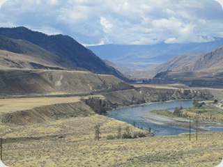
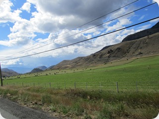
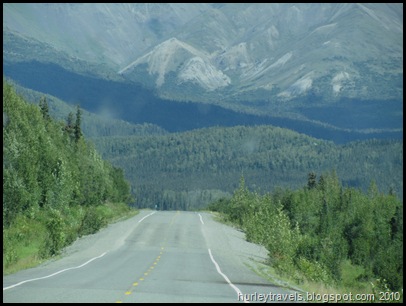
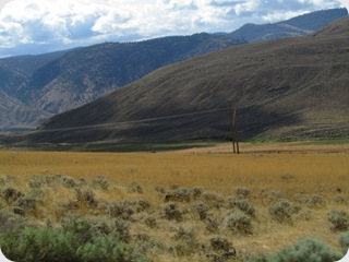
IMG_5786The next morning, heading southeast again, the spruce-lined mountains began changing to plateaus with valleys of sage brush, interspersed with bright green irrigated fields and sprawling ranches. 

  IMG_5774


IMG_5767


A place called 100 Mile House was our next overnight home. This small B. C. town was established as a post house on the Cariboo Wagon Road to the goldfields in the 1860s.  What a strange name, right?  We found this name, and the 108  Mile Ranch, the town of 70 Mile House, and others similarly tagged, a little humorous, especially since they were on roads marked in kilometers.  But then, we supposed that when they were named the mile measurement was in use. It must have been mostly a convenience for the miners who had to frequent the trail.   

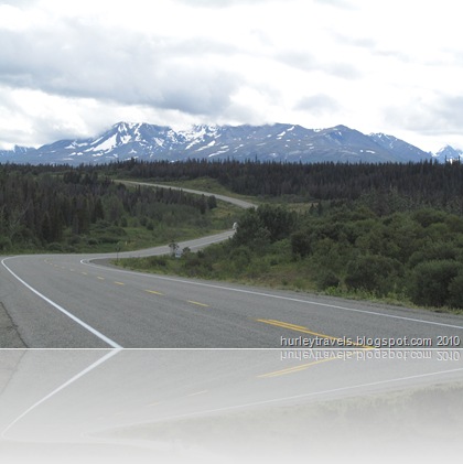
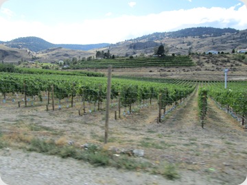
August 22 - The last day of the wrapping-it-up route, south on Highway 97, wound through resort communities, many steep and windy roadways and into the fertile agricultural valley.  The twisty mountain road runs along the Skaha and Okanagan Lakes.  It was  beautiful sunny day and many Canadians were out enjoying themselves in the Okanagon Falls beach community. The grapes vines and fruit trees covered the valley and hillsides as far as you could see in the fertile area in southern Canada as we approached Washington. Soon we were in the valley area, lined with orchards and vineyards. Everywhere we looked there were winery signs and fruit stands tempting us to stop. But since we weren’t sure of what foods we were allowed to transport into the U. S., we resisted.
When we reached the Canadian Customs at Osoyoos at 3:25 p.m. we were happy to see only three vehicles ahead of us in the line. Whew! But we did note the border agents asking each driver for their keys and opening the trunk of each vehicle.  We were the only rv.  So we wondered what was in store for us. Maybe this time we’d have to empty our rig.  So, now it was our turn.  We showed the courteous border agent our passports and answered the questions about where we lived and how long we had been in Canada and why. He didn’t ask us for keys to the Jeep. Everything seemed great…until…he tells us “Please pull forward to where the agent is standing.”  We see ahead of us about 30 feet a uniformed lady waiting.  She had more questions, like, “Do you have any pets?  Do you have any alcohol?  (Yes, one-half a bottle of wine.) Are you transporting anything for anyone else? Then she came inside the motorhome. “Do you have any fruit or vegetables?” Remember, we didn’t stop at those stands. Oh yeah,  I remembered that I had two tomatoes, so I said so.  She proceeded to look through our refrigerator and open some closet doors.  Then she finally asked for the tomatoes. (I had them in a cabinet.)  Turns out that they are one of the forbidden vegetables from Canada.  This experience coming over the border was a little different than three months earlier crossing into Canada.  That time we had thrown out wine and eaten all the vegetables. But, nobody asked.  After all is said and done, we only lost two tomatoes!  Makes you think though..are there bugs?  Yuck!  But, as we cruised back onto 97 south toward Oroville, Washington, we noticed the lines crossing into Canada, three of them, stretched several blocks long.  Glad we weren’t going that direction. But can you blame them for making a weekend trip over the border to buy groceries and fuel?  Those prices are one thing we won’t miss. 

Of course, we’ve been thinking and talking about our time up north as we hang out here in Washington enjoying the nice weather.   Maybe we’ll put together some of those impressions and conclusions and thoughts…..save them here with the other Alaska Adventure posts. We’ll see.

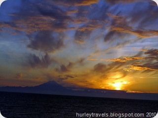
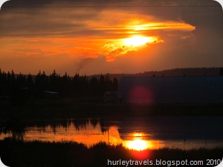
For now, I’m wrapping-it-up with these two closing shots:

Remember when I wrote about the awesome sunset on the evening of Summer Solstice in Alaska?  It was daylight until Midnight in Ninilchuk on the Kenai Peninsula.  Further north in Alaska there is sun until around 2:00 a.m. in the summer.


Ninilchuk, Alaska - Summer  Solstice - June 21     

From our spot in the Safeway parking lot in the town of 100 Mile House we saw this gorgeous sunset on the last night of our trip.


British Columbia, Canada --  August 21                 

Thanks for coming along with us on our Alaska Adventure.  Take care.  Talk to you later.
Thursday, August 26, 2010

Tiny Hyder Is An Eye-full – Alaska Adventure 2010

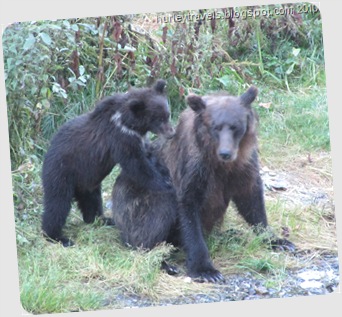
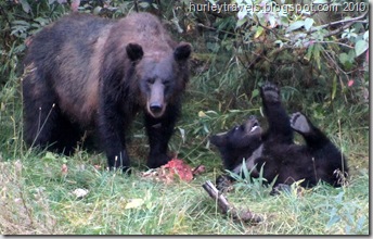
Aug 17 –19:  Some say Hyder is the place of all places to watch the bears. Baby grizzly wants Mom to play.  She isn't in the mood. They also say that the Cassiar spur leading there is an exceptional drive. Since our plan was to go south on the Cassiar Highway on our way back to the lower 48 anyway, we decided to make it our last destination for the Alaska Adventure. The small town of Stewart, B. C. and the even tinier town of Hyder, Alaska, population 100, are about two miles apart along the Portland Canal, that forms the natural boundary between Canada and Alaska.Hyder, Alaska, was a silver-mining boomtown in 1917-18.  Mining is almost non-existent now.  Forestry and tourism mostly fuel the economy. 


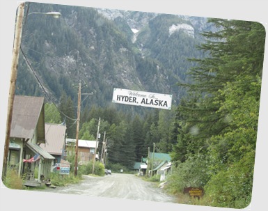
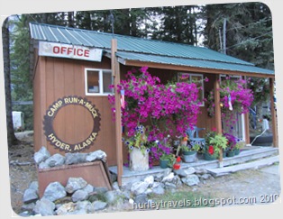
  As you drive out of Stewart on the two-mile stretch toward Hyder, you pass unnoticed by the Canadian customs office and the Welcome to Hyder, Alaska sign greets you.  There are about two city blocks, dirt road that is,  of the town of Hyder. The businesses include the Glacier Inn where people are “Hyderized,” the Sealaska Inn, a few gift shops, two “general stores,” and Camp-Run-A-Muck.  Yes, Camp-Run-A-Muck became our home for three nights.  It’s a clean and friendly establishment that’s the closest place to the bear-viewing location.  Camp-Run-A-Muck is really a misnomer for this park.  Everything seemed well-organized and the hosts provided excellent information on things to-do and see. The water and electric hookup sites are $22 and we had a shady spot in the pine trees to keep the refrigerator happy.  We enjoyed our stay.

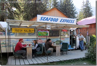
Our three days in Hyder included bear watching, halibut eating, limited shopping, bakery sampling, glacier viewing and mountain road driving. Did I forget to mention “The Seafood Express”  in my description?  Oh yes, there is one more block of businesses. Off the main drag in Hyder is this fabulous converted vehicle where Diana makes the best deep fried halibut and scallops ever.  We know other menu items have to be good too, but we were getting our fill on our favorites. Diana’s husband is a commercial fisherman who brings in the supplies.  They own the fish processing facility next door.  She’s been making her fresh dishes for 12 summers now, ever since she tired of hearing their processing customers say they thought they were coming to a restaurant.  Loved the place! (See photo below.)

Taking in the surrounding Tongass National Forest  and the ambiance of this little piece of Alaska was a great way to fade out of our Alaska Adventure.  Each photo below tells a bit more of the story of our time in Hyder.  If you would like to get the picture,  just run your cursor over your choices for a few more details.

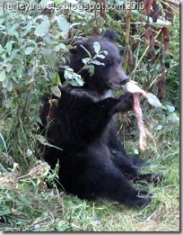
Grizzly cub enjoyed the salmon mom caught at Fish Creek.  He entertained us for the evening. 
Junior is cleaning up the scraps.
  Here's J.R. relaxing with an Alaskan Amber while we wait patiently for our fresh seafood at the Seafood Express in Hyder.   Our choice of restaurants in Hyder.
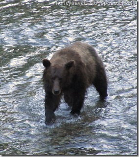
We watched the Grizzlies closely in their habitat at Fish Creek Wildlife Viewing area  just three miles from our campground.    They roamed, fished, ate and played.  This is the time of year when the bears are storing fat for their winter hibernation.
Grizzly Mom enjoys salmon while cub plays.
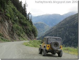
The 22-mile drive up the winding mountain road to the top of the Salmon Glacier is a feast for the eyes, but a little scary at points. Ole Yeller took the sharp turns on the sheer cliff dropoffs like a pro.  See a few of the views on our other photos.
Beauty of the Tongass National Forest
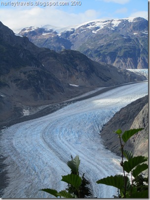
Salmon Glacier looking up toward the summit.  This is the fifth largest glacier in the world.  The scenery is breathtaking as you drive up Glacier Road and look over the steep roadside cliffs to the glacier.


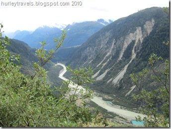
This view shows the river flowing down the valley from Salmon Glacier.  The river flows from the tip of the glacier, forming the "toe."
The Toe of Salmon Glacier 

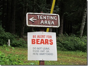
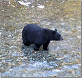
The resident black bear walked across our path as we were driving through Hyder, just before we came across this sign.  We are warned not to surprise a bear.  Many hikers wear bells to warn them humans are in the area.  And also, it is good to detour around areas where you see or smell carcasses of fish or animals.  That may be the bear's food stash and it may defend it aggressively.  Although most of the time the bear will avoid human contact.
Wise warning in Stewart, B. C. 
The mother grizzly watched the swimming Chum salmon in Fish Creek intensely.  Then she began her pursuit.  Soon she was reaching out with her huge paws and grasping the salmon. It was exciting to see her go through her food hunt.
Fish Creek, 3 miles west of Hyder, where many bears come to get their fix of salmon in August and September.
 This chubby black bear was our first sight when we arrived at Fish Creek.  Usually the brown and black bears are not cooperative in their feeding areas.  But when the salmon are spawning and the bears are stocking up for the winter, they share the bounty.
Black bear says: “Yummy, which one will I choose?”
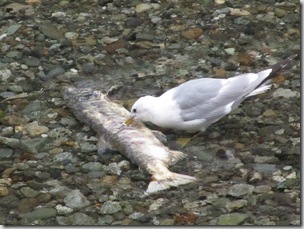
Salmon return to Fish Creek to spawn and then they die. The eggs are fertilized by their carcasses.
When the bears finish, the birds feast  on the spoils.
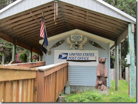
We got a laugh from the post office in Hyder.  Have you ever seen a branch like this one?
Hyder Post Office

Camp Run-A-Muck
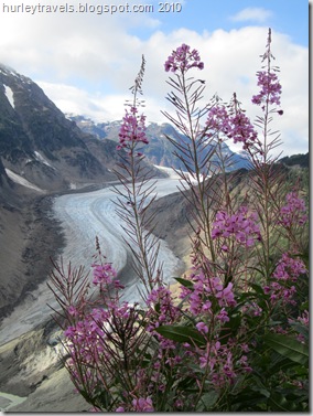
The Fireweed in  Alaska grows wild everywhere.  As the blooms shed it is a sign that summer is ending and winter is coming.  See the empty branches of this Fireweed bush?
Fireweed at Salmon Glacier
 
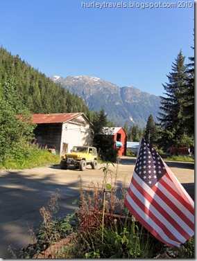
Hyder surroundings

Thanks for sharing our Alaska Adventure.  Talk to you soon.

Tuesday, August 24, 2010

Up and Over and Around – Alaska Adventure 2010

Aug 14 – 17:

What day is it and where am I?  During these four days we did occasionally lose track. Our travels brought us up, over, out, around and back, covering 970 miles from the U. S., into the Yukon, over to British Columbia and around into the U. S. again.  The last I wrote we were in Haines, Alaska, monitoring the wildfire burning near the Cassair Highway in B.C., our next destination.   Would the road stay closed and keep us from our planned route? The news on the Forestry Service site let us know we could not necessarily count on going south on the Cassair (37) once we came to the junction on Haines Highway follows the Chilkat River out of Haines and slowly climbs and meanders, up the pass and down, through a variety of forests and tundras.the Alaska Highway. And then there’s the continuing issue of Ferd’s air bag. Would the temporary fix keep us level for a while? On the 14th of August we decided it was time to go, regardless. Time to begin the exit to our Alaska Adventure, south to the lower 48.   

The first 250 miles from Haines, AK, to Whitehorse, Yukon’s capital, was smooth going. We were glad to be retracing the Haines Highway north, one of our favorite chapters in this three-month trip.    There’s nothing but nature, deep valleys with rivers running, abundant spruce and mountains painted in whites, browns and greens.  No roadside fuel stations, no McDonalds, not even very many fellow travelers.  This day was up out of Alaska, into the Yukon. 

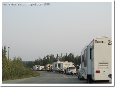
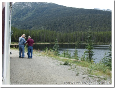
Our next day of travel was another 260 miles east on the Alaska Highway, thankfully without any road condition issues. But there was one unique experience.  Maybe this situation could be closely equated with camping out at the box office for concert tickets….Just waiting for an end result, hoping things work out the way you want.   When we arrived at the junction of the Cassair (37) and Alaska (1) Highways  we could see around the corner a short line of vehicles stopped.  At first, this looked like a good sign. They must be waiting to move on down the road, right? We all waited patiently in line for the Forestry officials to give the go-ahead to travel south on the Cassair, Highway 37.  The wildfires burned for weeks in this area of British Columbia, as they do annually.  Lightning strikes start many fires - Mother Nature cleaning house. Then we noticed that the rvs in line had awnings out and lawn chairs setup. People were walking around and gathering in conversation.  So we pulled into the line and asked: “What’s the story?” Answer: “We’re waiting, hopefully, to go down the highway tomorrow. They say that if all goes well there will be a pilot car to lead us through around 9:00 a.m.”  Okay, so what do we want to do?  It was already 6:00 p.m. and the parking spot’s free.  So, we chose to stay too. What a mix! There were a few locals just trying to get home in cars and trucks. The distant travelers ranged from Pennsylvania to Kansas and Vancouver to Ontario. We even had a participant from Sweden in his Class C anticipating the next leg of his trip.  As the evening progressed, people were making new friends, sharing halibut recipes and petting each others dogs.  And yes, the next morning, August 16, the pilot car did bring a line of travelers from the other end.  Then it was our turn. All of us, by then the line was about a mile back around the corner onto Highway 1, proceeded along the smoky road south.  After running the 42-mile gamut of the restricted road, we questioned whether these closures were necessary.  Here's our nice lunch spot at the edge of Summit Lake along the Cassair Highway.  Jerry helped some other travelers to get information on a camping site further down the highway. Smoke, yes, but no fire was visible anywhere.  We were released at the end of the closure to enjoy at our own pace.  We found a fantastic spot for lunch, at a rest stop on Summit Lake. During our break a few of the folks we met the night before, stopped by to chat. In our photo (right)  Jerry and two compatriots from the Cassair Highway lineup are consulting the  Alaskan Camping guide we have depended on throughout our trip. And later, we met some rving friends from the night before to share a pleasant pull off for the night. 

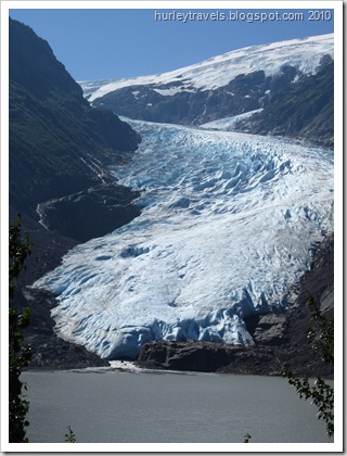
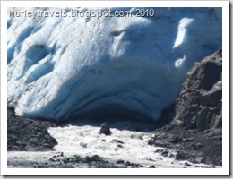
The Cassair through B. C. held up to our expectations for views as we continued south on August 17.Bear Glacier along highway leading into Stewart, B. C.  See the small opening at the bottom of the glacier where the melt is flowing into the lake.  A closer shot is on the right.  But we did take one side trip, exiting at the Stewart-Hyder Access Road, leading west for a spectacular 40-mile stretch. This highway winds through the steep-walled Bear River Canyon before moving up next to Bear Glacier in its frozen grandeur, hanging right out there along the highway. Close-up of Bear Glacier feeding a steady stream in the lake at its terminus.The terminus spills out into the Mezaidin Lake, feeding its murky water.  Here you can see  nature at work as the annual melt of the glacier flows out of this massive, aged ice structure.  (Put your cursor on photos for more info.)

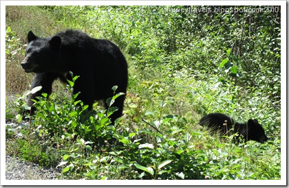
We had an extra bonus on this piece of road, also.  Just as we came along, black bears were out hunting berries or other vegetation for lunch.  We had four different sightings Black bear and her cub out foraging for a meal as we were traveling toward Stewart, B. C. and Hyder, AK, on August 17.  There was another cub with them, but the two babies were moving around too much to catch them all at once.  Soon Momma Bear turned and led them slowly back into the trees.  along the highway, the last being a black bear and her two cubs.   We gawked and they looked somewhat puzzled or aloof.  

As I was saying, this brings us up, around and over to the tiny town of Hyder, Alaska. (More later.)  After all the events and considerations, we were happy that we took this particular route with this particular timing.  It all adds up to another unique segment of our Alaska Adventure -- interesting and fun.

Talk to you later.  

Saturday, August 14, 2010

Haines, With a Splash of Skagway – Alaska Adventure 2010

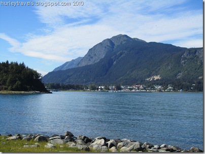
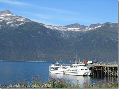
Aug 7- 12:  What happened to the last six days in Haines?  You know how it goes.  First you have coffee. Then you check email, etc. and have some more coffee. Maybe you make a little breakfast. Oh yeah, there’s the time it takes to discuss the blogs your hubby’s been reading since he got up four hours before you. Some days start by picking up where you left off on the book you were reading as you fell asleep last night.  Of course, there’s the Jeep to get washed, the windows to clean and the floor to sweep.  Haines, Alaska, in the distance, from just across Portage Cove, a part of Lynn Canal. And, how about the days when both of you just quickly get dressed and go out to explore the town.  Occasionally you have an appointment to keep, such as the ferry across the inlet to Skagway. That’s where the six days went!

We’ve been comfortably situated at the Elks Lodge in Haines since August 6.   The full hookup sites are very reasonable at $20 (lowest we’ve paid for hookups in Alaska) and the location is quiet. Even though the lodge is on “Main Street,” there just isn’t a great deal of traffic.  The most activity in our area is when the lodge has their Friday Feed, hamburger night, and Tuesday Taco night. We sampled the $8.00 tacos along with four of our rv neighbors the other night.  The food and the company were great.  We enjoyed talking with the four solo rvers traveling together through Alaska.  I should say, they are caravanning together.  Two ladies have Class C’s and one lady and one gentleman each have their own motorhomes.  They are from four different states and became acquainted through their singles rvers group.  You can imagine the kinds of stories we all had to share. 

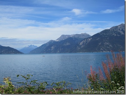
This small Alaska town is adding a few favorite stories to our list.  But if you crave the metropolitan lifestyle, Haines could disappoint you. The population, including the entire borough, is 2300 (some say that count is high).  We arrived by way of the only road to town, the Haines Highway, that leads directly to the shores of North America’s deepest fjord. For those who aren’t sure, a fjord is a long narrow waterway cut through bedrock by glacier activity.  Looking out on Lynn Canal, toward Skagway, where Nancy took the Fast Ferry. This one is called the Lynn Canal, about 2000 feet deep and 90 miles long.  It channels the inside passageway from Haines to Juneau and Skagway. Haines is surrounded by glacier-topped mountains rising from the sea and rivers.  You might say this is a picturesque place.   Duh!!  Again, as in other isolated Alaska villages or towns, it’s one of those places where you find a fair share of hardy, independent and self-sufficient individuals.  People that enjoy the close-knit community where everyone knows your name, but where you might also get lost if you wish. The weather during our visit has been a mixture of cloudy and sunny, temps in the high 60s to low 70s. They say there is plenty of snowfall in the winter for all the winter sports enthusiasts. Get the picture?  That’s what we like doing. We find it nice to wander around, see what’s where, listen, talk, observe and just gather the feeling of these towns and the surroundings.

So, I guess I answered my own question about where the last six or seven days have gone. Let’s see, I’ll list a few of the ways we’ve wiled the time away: Chilkoot River where the fishing for red salmon at this time of year is very competitive and lucrative.  The river is flowing swiftly into the Chilkoot Lake where the salmon are returning to their birth place to spawn.

--Drove out to Chilkoot Lake State Recreation Site to see the bears feeding on the spawning salmon. But our timing wasn’t that great.   So we watched the many fishermen casting for salmon, perched on there own chosen rock or choice spot in the swiftly flowing river.  A grizzly and her cubs were there just before us.

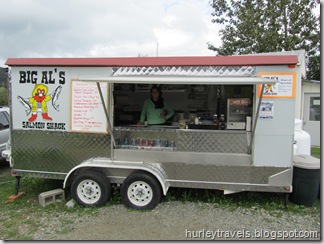
--Ate scrumptious halibut lunch, twice that is, from Big Al’s Salmon Shack, the trailer-type restaurant we found parked across the road from the wine store.  One of our first choices for halibut.  Fish and chips cost is $12.00.  That is the consistent pricing we are finding.After tasting the halibut we could see why the locals were frequenting this little place. On different days out, we also discovered the excellent soups, sandwiches and coffee at the Mountain Market Cafe.  Each time we drove within 1/2 mile to find perfect locations on the inlet to enjoy our lunches and the views. 

--Visited the American Bald Eagle Foundation. Since Haines is known for the 4000 bald eagles that gather every fall at the Chilkat Bald Eagle Preserve, this is a logical home for the foundation. During this time of the year there are only about 400 eagles here, mostly nesting and caring for the young.  Fortunately our timing was good to see the live raptor presentation and wildlife talk.  We met Zilla, the Lanner Saker Falcon, who can fly up to 200 mph to catch prey,Hunter was giving us a strong stare.  and Hunter, the Barred owl, who can rotate her head 270 degrees.    And she did so to keep her eye on everybody. Since Zilla would like to have Hunter for dinner, they were carefully separated by their handlers.  

We weren’t sure if we would stay for the wildlife talk. But, were pleased after a few minutes of hearing the speaker who provided some new details of various animals, for instance, the various types of salmon, their habits and traits. Of course, being in Alaska has made us more well-rounded salmon partakers.  But, more questions do come up.  Do we like sockeye, king, silver or what?  What’s the difference between sockeye and red and chum?  And why do they struggle desperately to swim upstream?  Why do we see different colors and shapes of the same type of salmon?  Well, we learned that the life cycle of an Alaska salmon is another wonder of nature. Among the many interesting facets is that the fish moves from river to salt water and back, readapting during the life cycle. During this readaption they change color and shape.   And when these Pacific salmon adults swim upstream, they are returning to the exact place where they were born in order to spawn, just once, and then die, thereby fertilizing the stream for the new fish. After swimming over 2000 miles in the Pacific Ocean, maturing, they instinctively return to their birth streams, fighting all the way, sometimes up waterfalls. That is determination!  As far as which tastes the best, we’ve done another one of those unscientific surveys and concluded it’s a personal thing.  But one thing we did learn.  The Chum is what they call Dog salmon and most everyone agrees that it should be kept for dog food.  Now, wasn’t it important that you know this?

--Increased our reading materials at the Babbling Book.  From our travels around the state and Internet reading about Haines we learned of a local author named Heather Lende.   She has written a couple of books, among her many other types of writing.  Her latest, “Take Good Care of the Garden and the Dogs” sounded like a good read to me.  And Jerry’s interest was peaked by “If You Lived Here, I’d Know Your Name.”  We stopped by the local book store and grabbed signed copies of each.   If I hadn’t been writing blogs maybe I would be close to finishing my first choice, as Jerry is his.  She has an engaging style. 

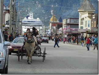
--Rode the Haines-Skagway Fast Ferry.Fast Ferries at Haines boat dock wait for more passengers tomorrow morning. Without going into a long explanation of why, our general delivery mail was delivered to Skagway, a 45-minute Fast Ferry ride for humans or a one-hour Alaska Maritime  Ferry ride for both the vehicles and humans. The two ferry transportation costs are logically much less for one than the other, but we were also comparing the miles to drive to Skagway, 359 miles compared to 15 across the water. After considering our options, cost of ferries, etc., we chose to make it a girl’s day, when I would have a few hours of leisurely time in the shops and museums. Skagway is the historic Klondike Gold Rush town where the multi-decked cruise ships frequent, a town that would be dubbed a tourist trap by some.  One that Jerry might not find so stimulating and that I would sort through much better as a loner.  So, with some concern on Jerry’s part about me going alone, I purchased the $68.00 round-trip ticket and cruised off with about 150 other passengers, mostly from the small cruise ship docked there in Haines.  There was ample sunshine so the views on our short boat ride were even more outstanding.  Skagway street scene.  There are carriage rides and shuttles if you choose to get around by other than foot.We had a guide/steward, presumably for the cruise ship passengers, who provided a few tidbits about the ice age and the gold rush.  Did you know that John Nordstrom was a Klondike gold rusher who came in 1897 to Alaska, made $13,000 on his gold mine stake and returned to Washington to open a shoe store?  You know the rest of the story. 

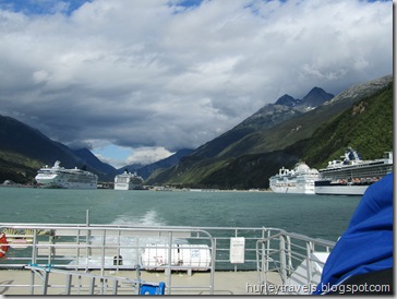
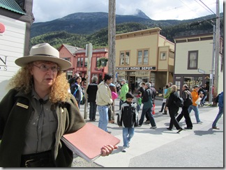
The ferry ride was smooth and quick. We were soon being dwarfed by the mammoth cruise ships on both sides of the Skagway harbor.  Even though I’ve seen them before, riding alongside in the catamaran ferry conjured up images of a whale swallowing a flea.   Once at the dock, it was a short walk on the 1/2 mile pathway to town and I was soon surveying my day’s activities. In a nut shell, I was This is Ranger Green in the midst of telling us about the people who built a cigar business, the local Skagway News and the Skagway Saloon.  Those three buildings across the street are the original sites.  pleased to find that the historic district is a national park and surprised at the number of diamond/jewelry shops in the tiny town.  I chose to go with the historic walking tour first. A small group of us followed our ranger a few blocks through town, pausing at the structures where events occurred from 1897-1900. She did a superb job of keeping us absorbed in the stories of the entrepreneurs who used their imagination and determination to build the town and become wealthy by accommodating the needs of the thousands who rushed there to find their fortunes. In essence, the business men and women in town were more successful than the miners who went into the mountains to look for their gold. I had a pleasant day of history and shopping, but passed up the diamonds and gold.  It was a beautiful ride back to Haines from Skagway on the Fast Ferry.And, of course, I picked up our mail at the Skagway post office. My ferry back to Haines was right on time. Here’s a photo as we cruised out into the Lynn Canal, away from Skagway, leaving the floating cities behind.  My yellow chariot was awaiting me at the Haines dock about 40 minutes, 15 miles, southwest.    

As I’m writing my post, we are still in Haines. I’m sure I’ve left out something. But this is too long already.   Maybe we’ll take another drive to see if we can get a look at the bears fishing for salmon dinner or just hang out at the harbor for a while.  Talk to you later.

Monday, August 9, 2010

Ride Along With Us Again – Alaska Adventure 2010

August 2 – 6:  Are you still with us on the road trip? The next segment takes us to Haines, Alaska, via the Tok Cutoff, Alaska Highway and Haines Highway. This might be the lengthiest post in miles and words in a year or so.  It just belongs together.  So here we go.

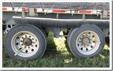
On the morning of August 2, after having coffee with the view of the Mount Sanford volcano, we resume our northerly trek on the Tok Cutoff.  We encountered a few patches of buckling road again (photo below), but mostly we had smooth sailing with the Wrangell Mountains and Copper Valley views.  The roller-coaster roadway along the Tok Cutoff provides some tickle-belly riding on the morning of August 2.  Ninety miles north we were back in the crossroads village of Tok for our second visit. We’ve written about Tok on our way into Alaska on June 2. Our one-night stopover this time was a fill-up and clean-up stop.  The Chevron offers free water and dump with fill-up, plus a free overnight parking spot.  They also have an rv and car wash, more seriously needed by those coming from the east on the Alaska Highway.  Markers on these tires help the truck driver know the axles on the trailer are turning.We took advantage of everything, including a nice out-of-the-way spot for the night, next to a quiet and congenial trucker.   This was an opportunity for Jerry to ask a question about a peculiar feature he’s noticed in this state.  See these yellow strips attached to the rims of this trailer’s tires?  We’ve also seen many tires marked with yellow paint in the same manner. Why? The trucker informed Jerry that when the driver sees these markers turning he knows that his axles are not frozen. That’s how cold it gets in Alaska!

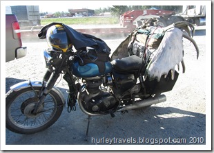
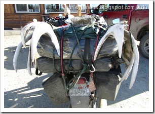
The next morning we decided to have breakfast at a popular Tok restaurant, Fast Eddy’s.  The accommodating parking lot had an assortment of rvs, semis, pickups and motorcycles. Just doing some shopping in Alaska for moose antlers. One ambitious motorcycle traveler from California had loaded his/her moose antlers onto the back.  Seems to me that this biker must have wanted this rack badly.Do you think this makes a good back rest?  We had to post a couple of these shots for Tim, Bobby, Tammy, Ron, Dick and our other biking friends.  Can you imagine riding from Alaska to California with this baggage?  Maybe they were on the way to their new cabin in the Alaska wilderness….just up this road.

For us, it was time to travel a stretch of the Alaska Highway that we had covered in early June. At that time we were pleasantly surprised as we didn’t find the treacherous road conditions that we had heard stories about before this trip.  People had warned us we might damage our vehicles on the frost heaves, have road crew delays and hit long gravel sections.  This wasn’t the case when we arrived. 

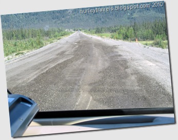
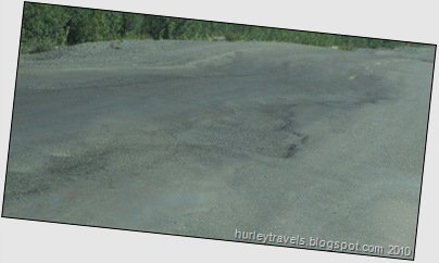
Thawing of the frozen ground in the Alaska Highway roadbed causes frost heaves.  These have actually had some repairs to them. Slowing down is not optional along this highway.But, wait.  On our return two months later it’s a new story.  We became acutely aware of how the thawing of the permafrost does cause havoc. The Alaska Highway trip from Tok to Destruction Bay was considerably different than when we came over a portion of this road before warm temps.

For about 175 miles, we rode the ruts, kept our eyes peeled for the orange warning flags and took it slow through the gravel areas. Look out for these dips!!The ground These vent pipes are a part of the cooperative experimental projects between American and Canadian engineers trying to change the traditional breakdown and resurfacing of the Alaska Highway.crews were busy trying to make some sections more travelable.    It’s evidently a never-ending battle.  I tried to get a good shot of the heaves, but these are the best I could do, even with the new camera’s features helping to steady me.   There’s one photo here of the efforts of American and Canadian scientists and engineers to slow down melting beneath the roadbed for a stable embankment.  The theory is that these devices (pipes) inserted into the ground will keep it at the proper temperature so that frost heaves will not occur.  Seems to be an ongoing dilemma. 


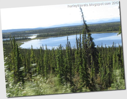
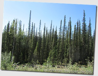
The freezing of the soil also creates an issue for the black spruce trees. Bottle brush spruce line the Alaska Highway between Tok and Kluane Lake. Traveling through this area, probably for 150 miles, you can’t help but notice these spindly bottle brush trees covering the hills and valleys.  Again, The Milepost gives me the answer.  “Where black spruce thrive, few other plants can survive.  They spread their roots in the boggy, shallow soil above permanently frozen ground. These skinny black spruce that appear to be very young trees can actually be very old.


Permafrost blocks water drainage and limits root growth and soil fertility. ….a tree two inches in diameter may be 100 years old.”   Also, their drooping branches invite forest fires to spread, forming a stepladder to the cones on their crown. The fire’s heat opens these resin-sealed cones, spreading the seeds for new trees to begin. Is that amazing?!

On today’s trip (August 3) on the Alaska Highway, if you are still with us after the bumps and dips, we are passing alongside and through places such as Deadman Lake, Beaver Creek, Snag Junction, Pickhandle Lake, Burwash Landing and Destruction Bay.  We crossed once again through Canada Customs, into the Yukon Territory, without any concerns, passports ready.   We averaged 43.9 miles per hour and traveled 237 miles in 5 hours and 23 minutes (according to Tillie the GPS). Our highest speed was 63 miles per hour, one time when we had a smooth stretch and passed someone moving at a snail’s pace.  Even though bumpy, it was a good day.

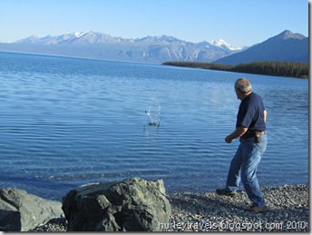
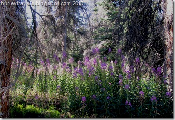
In the late afternoon we stopped at what is one of my favorite spots over the past ten weeks, Congdon Creek Campground on Kluane Lake.   It is a Yukon government campground, $12.00, no hookups.  We were able to get a site facing the lake and shading our temperamental refrigerator.   I am including a few photos that might explain somewhat my opinion of this location.  The fireweed in the woods is just behind our camp site. And then, of course, there we are playing around at the lake, a short walk from Ferd.   

Spot No. 1 at the Congdon Campground on Kluane Lake gave us a great view of the lake and was very private. And here's Kluane Lake!
Good one Jer.  That was three skips. The Fireweed was beautiful among the pine and spruce trees at the Congdon Campground.


The last part of this road trip I’ll take you on was shortened unexpectedly.  On August 4 we left our Kluane Lake home, looking forward to the long stretch of lakeside driving as we continued down the road flanking this scenic waterway.  But…..just a couple of miles into what would be the day’s 202-mile trip to Haines, Alaska, I smelled trouble – literally.  Any kind of burning smell, of course, sends off alarms, especially when you’re riding down the road in your home.   It seemed to be only in the front of the rig so we narrowed it to the small electric fan that Jerry was using for an extra breeze.   Yeah, that’s it.  Must be the fan motor. A quick stop at the pull off and we had replaced the fan and were smoothly rolling along again….  Not!  Whiffs of that mysterious smell were back in a few minutes. And the ride seemed less smooth, too.   It took us three stops, checking everyplace inside and out, in both the motorhome and the Jeep,  to finally narrow down that lingering smell.  Low and behold, we looked yet another time at the tires and saw up underneath the wheel well that the back, passenger side tire was definitely rubbing.  Long story short…..we have a problem with our leveling system. The valve on that air bag lets out too much air (in my simplistic terms). The next town, Haines Junction, was 70 miles away. Don’t ask me to explain it technically, but with Jerry’s magic maneuvering of the leveling and the ride height on Ferd, we slowly made our way into town.  

After pulling into the first empty lot we saw, we unhooked the Jeep and went into the local library to use the Internet, planning to contact fellow Foretravel owners on the internet forum.  Jerry monitors the site constantly and has learned to trust the regulars for providing knowledge and advice. So, he posted a question about our problem. We hoped for some good and quick suggestions. 

Meanwhile, back at the ranch…..we took Ferd slowly about two blocks further to the Kluane RV Park.  Without belaboring or relating the next two days of happenings, we gathered the best advice we could and adjusted and duct taped and tested.  Great news. The fix seems to be satisfactory, at least for now. But, should we make a change in our plans to go to a larger town east instead of going south?   Our best evaluation is that we can proceed as is.  So, we cautiously and hopefully, resumed our travels south on the Haines Highway (August 5).  We haven’t noticed any more alarming smell or listing to the right side.  The air bag is holding steady.  Things are good until we can get back to a dependable repair facility.

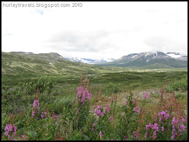
We had our lunch with this scene.  It is the Chilkat Pass, the summit of the Haines Highway, elevation 3,5 10.  The Tlingit natives guarded this pass for thousands of years, living on the land.  The gold rush of 1898 altered that lifestyle, although the people remain. Having said all of that, we were happy we kept to our plan. The road to Haines is another byway of tremendous natural vistas.  It reminded us of being in Denali National Park or the wilderness of the Denali Highway.  There are no commercial entities and very little traffic for the 146 miles.  Just lots of beauty. 

This guy was having lunch too. 


Well, it’s been nice having you along on this portion of our journey.  I’ll leave you with these last two photos from the Haines Highway, the view at our lunch spot at the summit, Chilkat Pass, and of a small creature who joined us there.    

Take care.  Talk to you later.
Sunday, August 8, 2010

Come Along With Us – Alaska Adventure 2010

Aug 1:  Recently our travels might be depicted as up-and-down. The scenery is a pleasure -- some of the roadways weren’t so perfect. Regardless, we’re happy to have taken this route after our latest Fairbanks stop, along the Richardson Highway south and the Tok Cutoff north.  Yes, it sounds like backtracking. But, not really.  These are two sections of Alaska byways we wanted to add to our ‘been there’ list, to complete the major roads of the state.

After two months of wandering Alaska, it’s still difficult to choose which of the awesome views are our favorites. Every time we take a new road, we seem to lengthen the list of possibilities. Maybe you’d like to come along on this road trip and give us your opinions.  I’ll take you with us us via photos mostly…..with less than usual comments.. if I can.  

Here’s the route: You’re taking the Richardson Highway (4) southeast from Fairbanks, about 240 miles,  to the Tok Cutoff (1). Then you’ll go northeast on the Tok Cutoff for 35 miles to our overnight spot at the  Chistochina River.  

So climb in and get comfortable.  We make our way east out of Fairbanks, soon passing by Eielson Air Force Base, the largest aerial range in the country, 60,000 square miles where military flight training happens on F-16s.  We stopped at Delta Junction for our clam chowder lunch that we stocked in at Fred Meyer in Fairbanks. (Highly recommend their deli soups.)  Then Ferd angled us right, taking the Richardson south at the split instead of the Alaska Highway east.

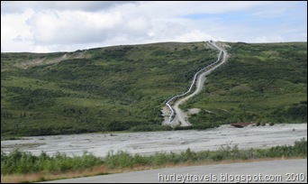
It isn’t long until you’ll start to notice the views of the trans-Alaska pipeline The 800 miles of oil pipeline were completed from Prudhoe Bay to Valdez in 1977. The oil travels at 5.59 miles per hour.  The pumps can move 754,285 barrels a day, 22,000 gallons of oil a minute.snaking along the Richardson, popping in and out, underground and over ground. Why isn’t all of it buried?  Nature made that decision, I guess. In spots where the warm oil would cause the icy soil to thaw and erode, the pipes are above ground.  The pipeline even has an earthquake detection system that checks critical valves and supports after any activity. Here's a look at a stretch of line above ground along the Richardson Highway.  Where the frozen ground is well-drained gravel or solid rock, thawing is no problem, so the pipeline is underground. The vastness of the landscape seems to almost consume the line.


(Pass your cursor over these two photos if you’d like a little more info.)


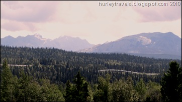
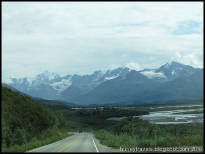
But… I just remembered.  This is a photo trip, with limited commentary.  So, let’s get back to that.  The following photos are of glacial and river and lake views as we travel southeast on the Richardson Highway……They don’t need any words.The Richarson was Alaska's first highway.  It began as a pack trail in the late 1800s.  This road is known as one of the state's most scenic routes.

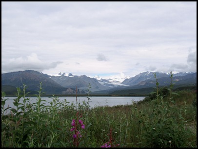
View of Gulkana Glacier  in the distance from the shore of Summit Lake. A very nice spot where we took a break, at about 197 miles southeast of Fairbanks on the Richardson Highway.

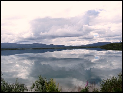
I don't know the name of this lake but the reflections were so outstanding on this day, it had to make the cut on blog post photos!


When we are about 240 miles from Fairbanks, we make a sharp left (might even be called a u-turn) onto the Tok Cutoff, Highway 1, the northeasterly part of today’s trip.  One part of the journey so far that I didn’t mention is the frost heaves that started providing loop-de-loops on about the last third of the Richardson Highway segment.  Well, the problems continued on the Tok Cutoff, but worse.  Jerry slows down.  You’ll have to help now.  Concentrate on watching for those orange flags stuck into the burm marking the holes, dips and bumps.  This isn’t much fun, but with the thawing of the ground after Alaska’s frigid winter weather, that’s just how it is. I guess I was too busy watching the road to get a good shot today of those heaves.  Later.
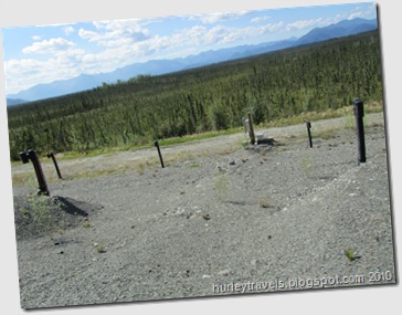
When we were ready to settle in for the night, the Chistochina River trailhead offered a spacious, paved parking area well off the highway and the views were exceptional.   With several hours of daylight still available at the 6:00 p.m. hour, we watched the clouds float by and had a restful night.
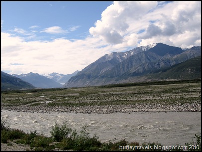
The Wrangell St. Elias National Park and the Chistochina River border the Tok Cutoff Highway for this 90-mile portion.

Hope you enjoyed the trip.  Talk to you later.